5 plants worth knowing
St. Vincent & Grenadines
Saint Vincent is a steep volcanic island dominated by the active volcano La Soufrière; its interior is clothed in humid rainforest and cloud forest, and its fertile valleys in plantations of bananas, arrowroot and breadfruit. The Grenadines to the south are lower and much drier, with dry scrub, white beaches and reefs. Kingstown is home to a botanic garden founded in 1765, considered the oldest in the Western Hemisphere.
Hover over a plant to see on the map where it grows.
where it grows
-
 1
Soufrière tree
Spachea perforata
A rare tree from the slopes of La Soufrière volcano, which gave it its name – a national flower few islanders have ever seen in the wild.
-
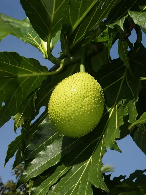 2
Breadfruit
Artocarpus altilis
Breadfruit was brought here in 1793 by Captain Bligh – today roasted breadfruit with fish is the national dish of Saint Vincent.
-
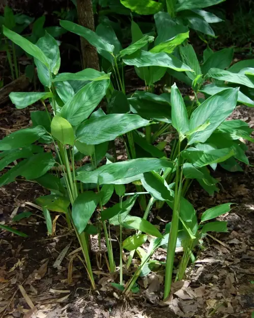 3
Arrowroot
Maranta arundinacea
For decades Saint Vincent was the world’s largest producer of arrowroot – a delicate starch from the rhizomes of this plant.
-
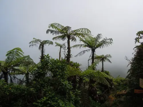 4
West Indian tree fern
Cyathea arborea
Ferns as tall as trees cover the misty slopes of La Soufrière – among the first plants to return to volcanic wastelands.
-
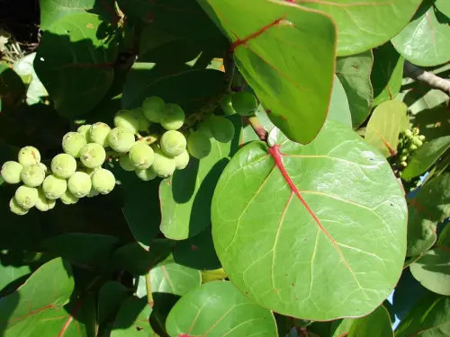 5
Sea grape
Coccoloba uvifera
The sea grape, with its round, leathery leaves, gives shade on the beaches of the Grenadines – from Bequia to the Tobago Cays.
St. Vincent & Grenadines on other Ominuvo maps
- World in NumbersPopulation: 99,924 (2025)Source: World Bank – WDI: UN World Population Prospects (CC BY 4.0)
- Languages of the worldEnglish · official languageSource: Unicode CLDR (Unicode License v3)
- Prices around the worldEast Caribbean dollar (XCD)Source: ISO 4217
- Time zones mapUTC−4Source: IANA tz database (public domain)
- Plugs and sockets of the worldType A, C, E, G, I, K · 230 V · 50 Hz
- National dishes of the world1 national dish
- Volcano & earthquake map1 volcanoSource: Smithsonian GVP (Smithsonian Terms of Use)